Engineering surveying
Complete surveying services delivered throughout the Czech Republic and abroad: from measured building surveys and engineering surveying to cadastral work and mapping.
Measured building surveys
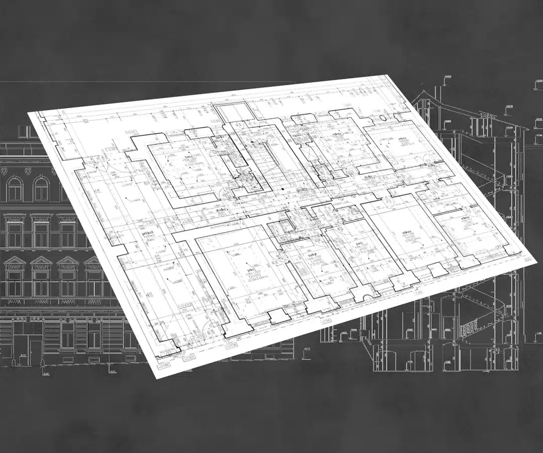
We specialise in measured surveys of historic and industrial buildings and in producing digital building survey documentation. We work alongside construction specialists, which keeps the results professionally sound.
Together we have completed dozens of commissions for Czech and foreign investors and for public authorities. The documentation is drawn in detail at 1:50 (or 1:25 and 1:100) and includes full annotation and dimensioning.
- 2D digital building survey documentation (floor plans, sections, elevations)
- Building condition surveys and photographic records
- 3D modelling and visualisation
- Overlays with orthophoto views generated from point clouds or 3D models
- Surveys for as-built documentation
Engineering surveying
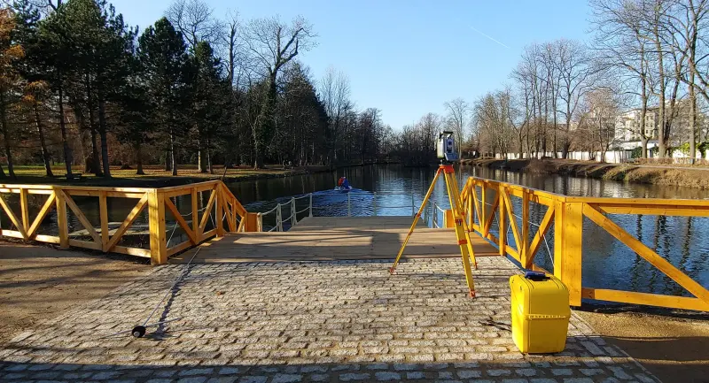
We cover the full range of engineering surveying. Our experience and equipment let us handle most of the work that falls into this field. All work is carried out by authorised surveying engineers using Trimble instruments.
- Setting out of structures, linear works and earthworks
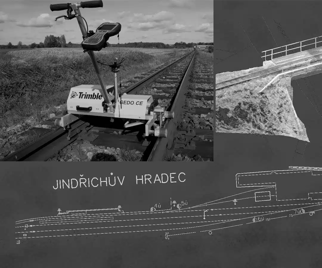
- Surveys of absolute track position (APK) and track geometry parameters (GPK) on railway lines
- Acting as the authorised surveying engineer
- Establishing the primary setting-out network for a site
- Surveying of cross sections and longitudinal profiles
- Surveying and calculation of areas and volumes
- Monitoring of displacement and deformation
- Verticality checks and adjustment of three-dimensional networks
- As-built surveys and surveying documentation
- Specialised surveying work on construction sites
Cadastre of Real Estate
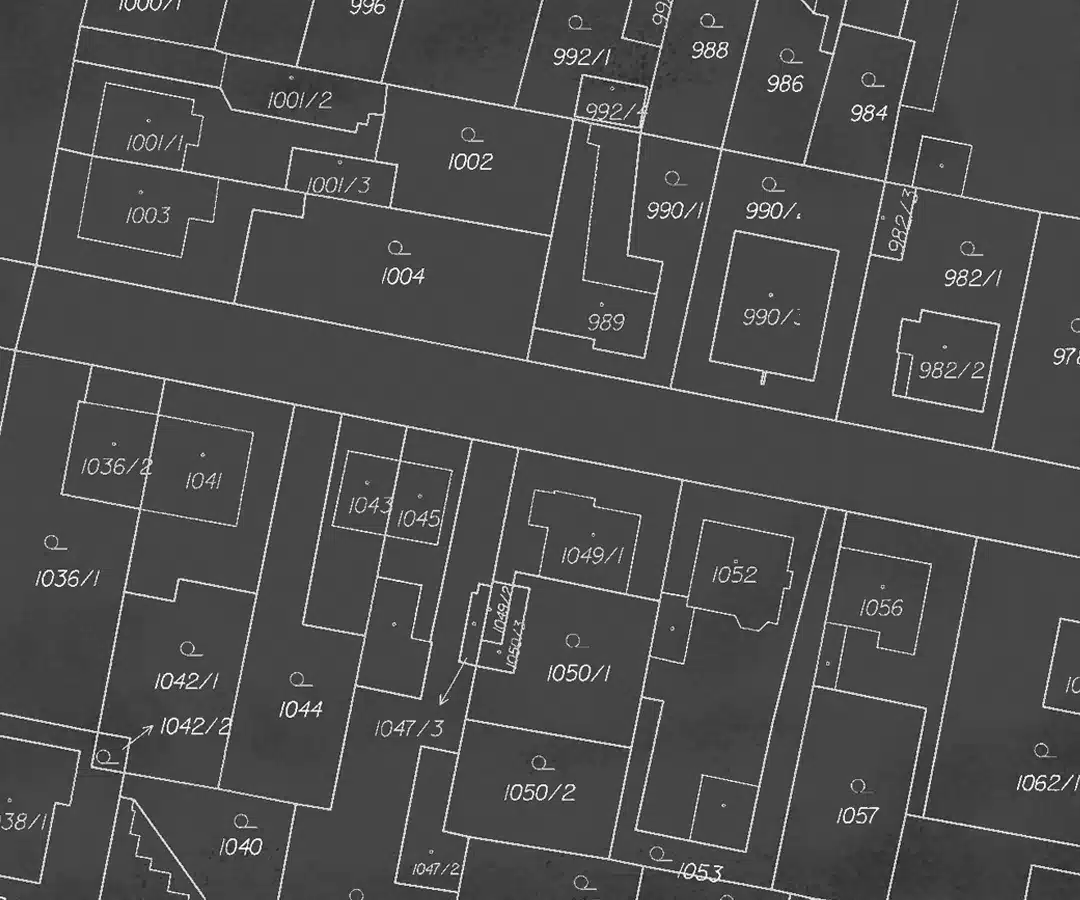
If you own a property or plan to, you need to know its legal boundaries and its area. That information is held by the Cadastral Office, but the surveying itself is carried out by private companies.
Surveys for the cadastre must comply with Act No. 256/2013 Coll. and must be certified by an authorised surveying engineer. We have worked in the field since 1991 and will help you settle the title relationships of your property.
- Surveying sketches (geometrický plán) for recording a building: under construction, for occupancy approval or for a change of use
- Surveying sketches for subdividing land and refining boundaries
- Surveying sketches for recording an easement
- Setting out of legal boundaries
- Subdivision of land held by several owners
- Registration of the surveying sketch in the cadastre
- Adding land recorded in the simplified register to the cadastral map
- Advice on Cadastre of Real Estate matters
Mapping
For many years we have worked with design studios, utility network operators and investment organisations, producing complete mapping data for them. The data is always delivered digitally, to the client’s own specification or internal standard.
Title relationships are always resolved as part of the work. Our equipment and experience also allow us to take on the digitisation and vectorisation of existing map records.
- Topographic and planimetric surveys and production of 2D/3D digital maps
- Digital terrain model (DTM)
- Production and maintenance of large-scale special-purpose maps
- Establishing and densifying control networks
- Digitisation and vectorisation of existing map data
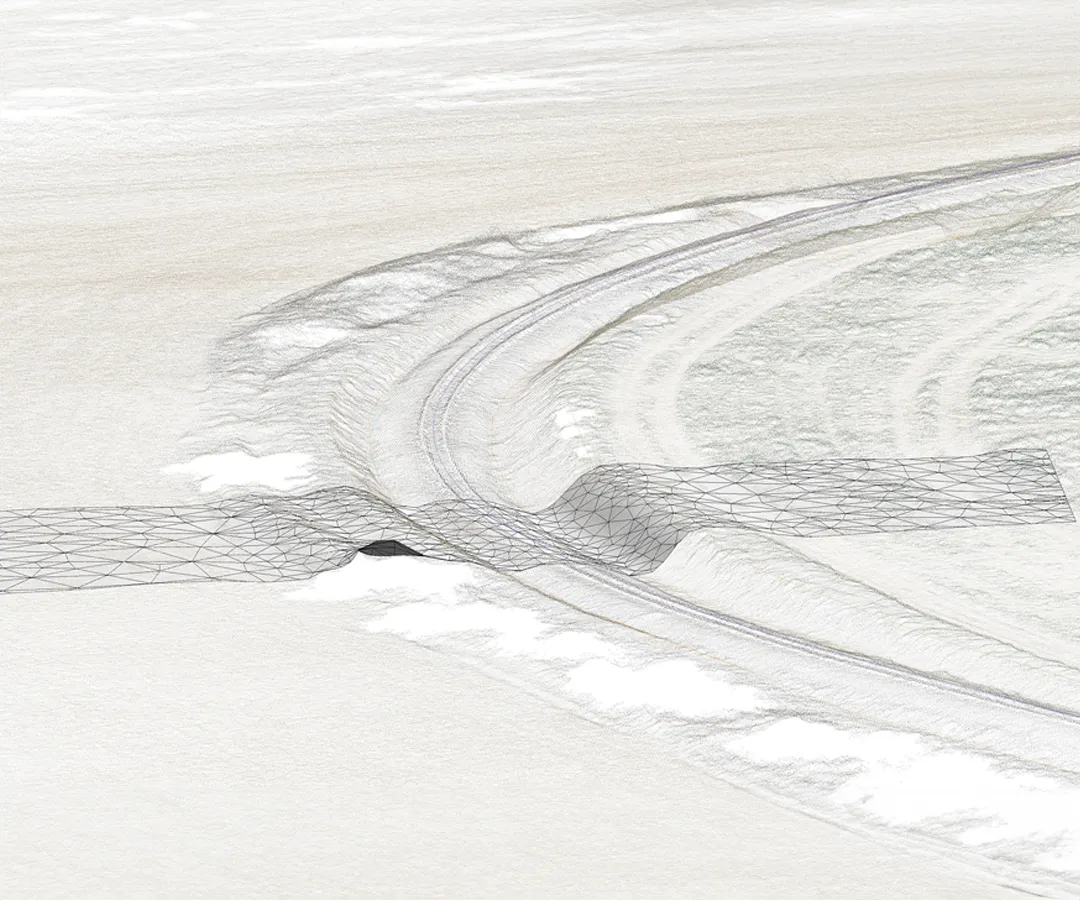
Official authorisation
We hold the authorisations required for all surveying activities throughout the Czech Republic under Act No. 200/1994 Coll.
Authorisation under Section 13(1)(a)
Certifying the results of surveying activities within the scope of survey work for the Cadastre of Real Estate
Authorisation under Section 13(1)(b)
Certifying the results of surveying activities within the scope of engineering surveying
Authorisation under Section 13(1)(c)
Certifying the results of surveying activities within the scope of producing maps and mapping data
Selected projects
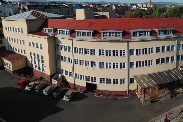
Mattoni
Survey of a former bottling plant in S-JTSK and Bpv.
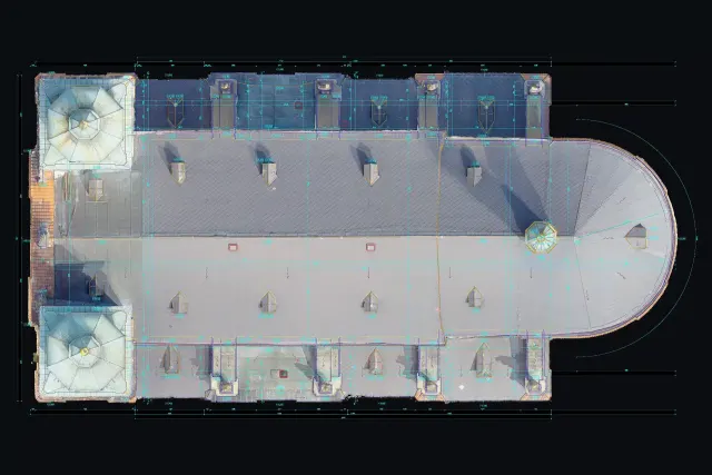
Bohosudov Basilica
Documentation of a historic basilica.
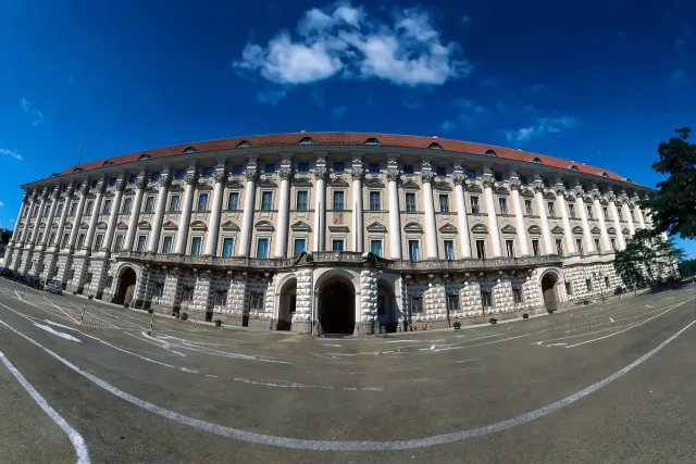
Czernin Palace
Documentation of a Baroque palace.
What working with us looks like
From the first enquiry to handing over certified deliverables: a clear process with no surprises.
Consultation
We go through your requirements, visit the site and propose the right approach. We advise on the method and on how detailed the documentation needs to be.
Field survey
Measurement with GNSS, total stations and other Trimble equipment. Accurate data is the basis of a sound deliverable.
Data processing
Computation and drafting in Groma and other professional software, with a quality check at every step.
Handover
Certified deliverables stamped by an authorised surveying engineer in DWG, DGN, PDF or any format you need, including registration in the cadastre.
What clients ask
How much does a survey of a building or a plot of land cost?
The price depends on the size of the site, the drawing detail required (1:50, for example) and the type of deliverables. We price every project individually and will send a free, no-obligation quote within 48 hours.
What is as-built documentation?
It is a measured survey of the building as it stands, together with drawings: floor plans, sections and elevations, usually at 1:50. It is used for facility management, for designing refurbishments and in dealings with the building authority.
What does certification by an authorised surveying engineer mean?
The deliverables are certified by an authorised surveying engineer (AZI; until 1 July 2023 the Czech title was úředně oprávněný zeměměřický inženýr, ÚOZI). Three members of our team hold this authorisation, so the documentation meets the requirements of building authorities and of the Cadastre of Real Estate.
How quickly will I get the deliverables?
The schedule depends on the size of the job. We propose a timeline together with the quote at the initial consultation and confirm it in advance. We reply to enquiries within 48 hours.
Have a project we could help with?
Get in touch for a no-obligation consultation. We will send a free quote within 48 hours.