UAV mapping
Aerial photogrammetry by drone with RTK correction for precise mapping of large areas. Orthophoto maps, digital terrain models and volume calculations accurate to within 3 cm.

Aerial photogrammetry
We use the professional DJI Matrice 4E drone for precise mapping of large areas. RTK correction gives us positional accuracy within 3 cm without needing a large number of ground control points.
We process the data in Pix4D and deliver the results as orthophoto maps, digital terrain models, point clouds and textured 3D surface models. One day of flying covers up to 1,000 ha.
- Orthophoto maps with a resolution down to 1 cm/px
- Digital terrain and surface models (DTM/DSM)
- Point clouds from photogrammetry
- Textured 3D surface models
- Contour plans and terrain sections

Epoch measurements
We fly construction sites and extraction areas at regular intervals to track progress and calculate volumes. Epoch measurements give an accurate comparison of the situation over time.
The deliverables include difference models, volume calculations between epochs and clear reports visualising the changes. The data can be held in Pix4D cloud storage so the client has easy access.
- Monitoring of construction progress at regular intervals
- Comparison of the as-built state against the design
- Volume calculations and difference models
- Pix4D cloud storage for sharing data

Volumes and quantities
UAV mapping is the right tool for calculating the volume of earthworks, material stockpiles and extraction pits. Compared with a conventional ground survey it gives a far higher point density and faster data capture.
We calculate from digital terrain models at an accuracy comparable to a ground survey. The results serve as the basis for invoicing earthworks and for checking material quantities.
- Volume calculations for earthworks
- Monitoring of landfills and extraction sites
- Difference models between epochs
- Source data for invoicing construction work
Professional technology
We use top-grade equipment for UAV mapping, with the emphasis on accuracy and reliable results.
DJI Matrice 4E
A professional drone with RTK correction for centimetre accuracy without ground control points
Pix4D Processing
Professional software for processing aerial imagery: orthophoto maps, point clouds and 3D models
Pilot licences A1/A2/A3
Authorisation to fly in all categories under the EU regulation, including operations close to people
Selected projects

Land consolidation
Aerial survey of a cadastral district for land consolidation (UAS eBee X).

Dolní Chabry church
Documentation of a church building.

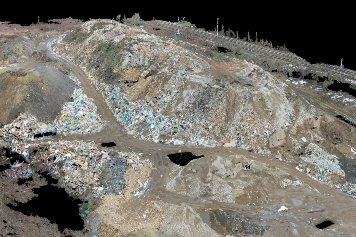
Malešice landfill
Volume survey carried out with a UAS.
What working with us looks like
From flight planning to handing over finished deliverables: an efficient, transparent process.
Planning
We design the flight plan, obtain clearance from air traffic control and set out ground control points for the best possible accuracy.
Flight and data capture
An automated flight with RTK correction. Systematic image capture with a defined overlap and resolution.
Processing in Pix4D
Photogrammetric processing of the imagery, producing orthophoto maps, terrain models and point clouds.
Handover
Deliverables in GeoTIFF, LAS, DWG or any format you need, shared through Pix4D cloud storage.
What clients ask
Where are you allowed to fly? Do you hold the necessary authorisations?
We hold UAS licences in categories A1, A2 and A3 and we fly in accordance with the rules of the Czech Civil Aviation Authority. We cover the whole of the Czech Republic.
How accurate is drone mapping?
Aerial photogrammetry with the DJI Matrice 4E reaches an accuracy of a few centimetres, which is enough for orthophoto maps, digital terrain models, epoch measurements and volume calculations.
How much does UAV mapping cost?
The price depends on the size of the area, the accuracy required and the type of deliverables: an orthophoto map, a digital terrain model or volume calculations. We will send a free, no-obligation quote within 48 hours.
What is UAV mapping good for?
Mapping large areas, land consolidation, monitoring landfills and construction sites, epoch measurements and volume calculations, all faster and more economically than conventional ground methods.
Have a project we could help with?
Get in touch for a no-obligation consultation. We will send a free quote within 48 hours.